15 KILOMETERS OF TRAILS!
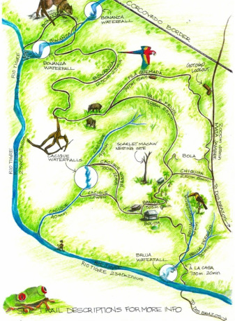
The trails are what will make your visit to BOLITA unforgettable. The 15 kilometers of trails that meander through 61 plus hectares of rain forest, will take you through various elevations of primary and secondary forest. You pass by four creeks that run through the property, numerous waterfalls, various spots with fantastic ocean views, as well as the beautiful Rio Tigre, which skirts BOLITA for two kilometers. Because of the diversity of habitat, it's a great area for spotting much of the flora and fauna that exist in this amazing place.
We've been careful to make the paths comfortable for walking by keeping each as horizontal as possible, and adding steps where necessary. One of our most important ongoing projects is to replace the old stairs with used tires.
DAY HIKING:
Even if you're not staying at Bolita, day hikers are welcome to come and enjoy the Bolita self guided trails for the day at $10 US per person. For day hikers, please stop in at the Bolita office in Dos Brazos, for a map and instructions. Also, guided tours can be arranged upon request.
Trail Highlights
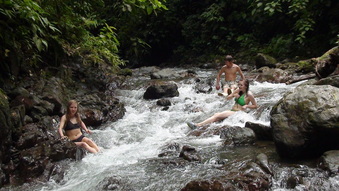
Rio Tigre
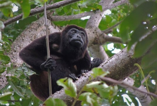
A LA CASA: The first you'll encounter. It's the path to the house, and it's lush with life as you wind through the Bruja creek valley. We often spot Spider or Capuchin monkeys foraging here, and you'll definitely hear from the howlers.
BANANA: This trail is the main route to access most other trails and locations. It takes you through the old banana plantation, and a patch of mango trees, plentiful in May and June.
CHIQUITA: As the name indicates, this is a rather short path across a hillside, just above former pasture. Here you will see the beginnings of forest re-growth in the form of Balsa and Capuline trees. Leads out to MATA JAMBRE.
BONANZA: is the crown jewel of our trail system, taking you deep into primary forest, and ultimately leading to the two largest waterfalls at Bolita. From the waterfalls you can turn back and follow a slightly different route back, or continue a 2 hour (minimum) breathtaking hike down Rio Tigre, back to the entrance of the property.
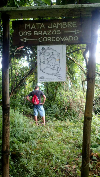
VALLE FRIJOL: You will be walking a mostly horizontal path cut into the hillside over looking the Cacique valley. You are at a high enough elevation to get views of the Golfo Dulce and Puerto Jimenez in The distance.
FILA QUEMADA: At an even higher elevation, this ridge overlooks the VALLE FRIJOL trail and the cacique valley, as it menders in and out of old and second growth forest. Stop and sit for a rest with a view along the way looking down at the treetops and the Golfo Dulce. It was once on fire! This was the typical way to clear land for farming. Now, happily it is in the process of re-growth.
RIO TIGRE: This is a breathtakingly beautiful way to come back to Bolita after your hike to the Bonanza. Explore a whole new habitat, in a scenic river ankle to knee deep, with a few chest deep crossings along the way. You may even meet a gold miner or two, as panning river gold is still the main source of income for many of the towns' people. Expect to use the better part of a day if you do the Bonanza/Rio Tigre hike.
THE GOTTOGO LOOKOUT: The highest point at Bolita, and is one of the best views you'll see of the Golfo Dulce anywhere. For a special treat, walk up just before dawn, and watch the sunrise over the gulf. It's a spectacular site!
TOURS IN CORCOVADO PARK and BOLITA
If you're interested in a park tour we recommend you do a tour either before or after your stay at Bolita, in order to take full advantage of the Bolita trails while you're here. Our location is very remote, and while we are beside the park, we are no close to one of the official entrances. There are many more convenient places to stay if you are specifically looking for a guided park tour.
For tours on the El Tigre Corcovado trail located in Dos Brazos, Visit corcovadoeltigre.com, or call 506.8691.4545. As well birding, horseback tours, or horse rentals, gold mining tours, and more, all available from the local residents of Dos Brazos.
Also Highly recommended for tours starting at one of the other entrances to Corcovado Park is ficustours.com based in Puerto Jimenez.

